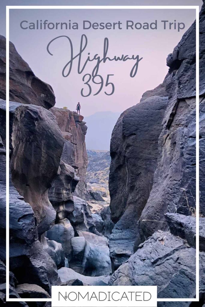
25 Overlooked Stops on Highway 395 for an Epic Lake Tahoe to LA Road Trip

Wondering where to stop between Los Angeles and Lake Tahoe on a California Highway 395 road trip?
Ghost Towns. Salt Columns. An abandoned city plan. Discovering Highway 395 road trip attractions isn’t as easy as stumbling upon them beside the interstate. It requires mapping your route before losing your cell signal heading off on dirt roads.
With true crime podcasts blaring to keep me awake, I embarked on the final stretch of my multi-month vanlife adventure through the California deserts. This leg marks the end of an epic 5000+ mile road trip exploring the American Southwest.
Here is a compilation of all my previous California road trips, creating a detailed guide for a 25 stop Highway 395 road trip guide from Lake Tahoe to Los Angeles. We will begin with the top attractions south of Lake Tahoe and make our way back towards LA County.
25 Best Highway 395 Attractions Worth Detouring For
The post will follow a route going south from Lake Tahoe to LA driving on US 395. Under each detour, you’ll see the mileage count of how far you are still from Los Angeles.
Note #1: Many of these California desert attractions require getting off the highway and getting down and dirty with dusty dirt roads.
Note #2: Factor into your road trip budget that National Parks and state parks have an entrance fee per vehicle.

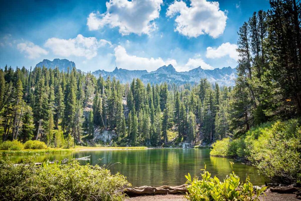
1. Lake Tahoe
444 miles from downtown Los Angeles
Split between California and Nevada, enjoy the crisp mountain air and breathtaking views of Lake Tahoe’s shimmering blue waters. Lake Tahoe is often touted as a year-round playground, and I have experienced both the joys of summer and winter.
In the warmer months, the lake becomes a hub for water sports, such as boat rides, paddle boarding, and sailing. On land, hiking trails span the circumference of the lake, with paths ranging in difficulty to accommodate all levels of adventurers.
When winter descends, Lake Tahoe transforms into a snowy wonderland, attracting legions of snow sports enthusiasts. With several world-class ski resorts, such as Squaw Valley and Heavenly, it’s a paradise for skiers and snowboarders alike.
Travel Tip! Most roadtrippers don’t realize how big Lake Tahoe really is. It takes an hour to drive from the north to the south.
People typically opt to stay in South Lake Tahoe, but there are hundreds of beaches, trails, and viewpoints along the entire lake.
2. Bodie State Historic Park
364 miles from downtown Los Angeles
Bodie State Historic Park is the perfect setting for an Old West fantasy Hollywood film. With its old wooden church and remnants of a bygone era, the restoration efforts have successfully preserved the essence of America’s Wild West and cowboy past.
Once a bustling gold-mining town in the 1800s, Bodie now stands abandoned, frozen in a state of “arrested decay.” Follow the winding path along the main street, peeking into houses, churches, and shops that stand frozen in time.
Entrance Fee: As a state park, there is an $8 entrance fee per vehicle.
GPS Location: (38.213764, -119.015661)
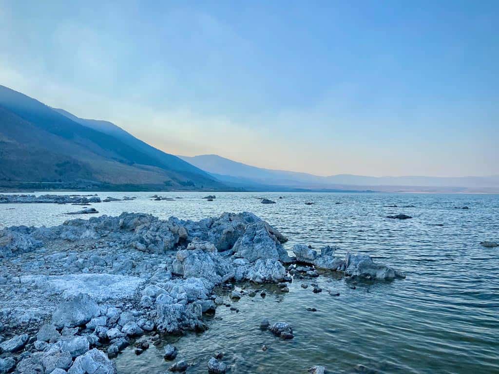
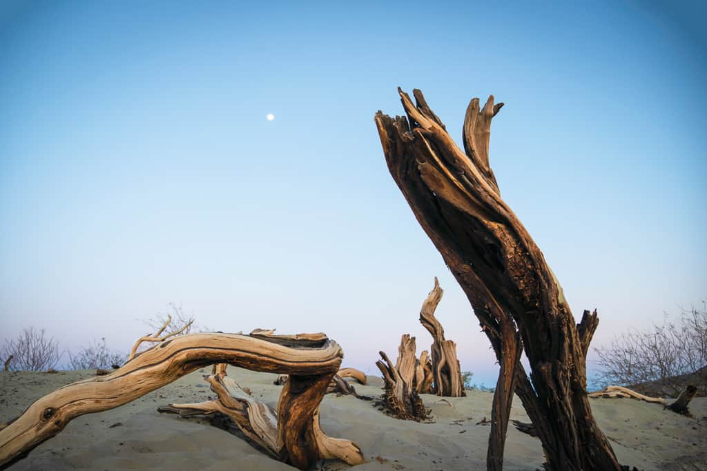
3. Mono Lake Tufa State Natural Reserve
335 miles from downtown Los Angeles
Mono Lake, located near the town of Lee Vining, is one of the strangest bodies of water you’ll find anywhere. It’s so alkaline that it only sustains tiny brine shrimp and the alkali flies that hang out along its shores….and boy, are there many flies.
If you have trypophobia, avoid looking down as you near the water. As you approach, masses of flies will disperse like the parting of the Red Sea.
When the lake level started to decline in the twentieth century, some odd geological features were exposed. This eerie yet mesmerizing lake is now illuminated by hundreds of calcium carbonate tufa columns, created when mineral-laden underwater springs met the lake’s water.
Come here for a sunrise or sunset as the sun kisses each of these unique rock formations with a radiant orange glow.
Access: There are many access points and small hiking trails to Mono Lake.
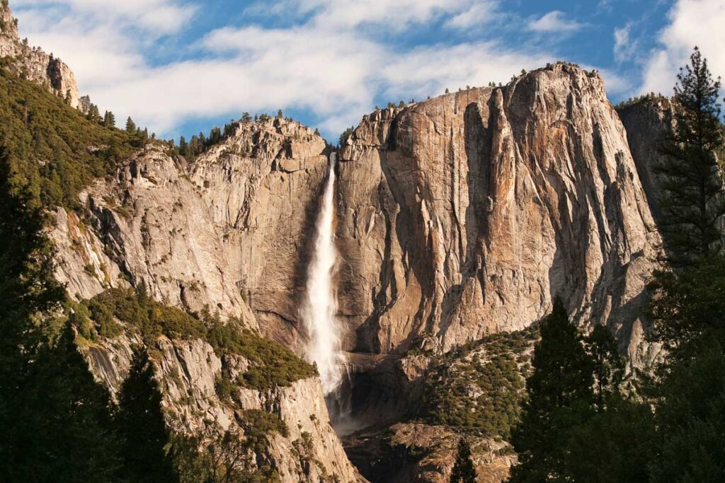
4. Yosemite National Park
410 miles from downtown Los Angeles
During the summer, you can access Yosemite by taking the Tioga Pass Road off the 395 right before the town of Lee Vining.
With its towering granite walls, giant sequoia trees, and plummeting waterfalls, Yosemite offers one of the most impressive landscapes you will ever see.
Whether it’s an afternoon drive that takes you to some of the valley’s main attractions or a full day hike through the backcountry, make sure you don’t miss Yosemite Falls and the panoramic views after hiking Half Dome and El Capitan from Glacier Point.
Access: The Tioga Pass Road closes during winter due to excessive snowfall.
How to Get to Highway 395 from Yosemite National Park?
If you are driving from Lake Tahoe or the southern coastal cities, stick to the inner California highways. But what if you are visiting from Yosemite National Park or Sequoia National Park?
There are no mountain pass routes between California Highway 140 in Yosemite National Park and Highway 58 via Bakersfield, an over 200 mile drive!
Highway 140 Tioga Pass is the first mountain pass that crosses over to Highway 395. The other options are north of Tioga Pass: Highway 108 over Sonora Pass and Highway 4 Ebbetts Pass.
All three routes are closed due to snow in the winter season early December until mid-May to early June. All routes wind through mountainous roads, causing long detours, but it is certainly a scenic drive.
If you’re driving in the winter, your only two options are:
- Cross Highway 50 (open year-round), which takes you to Lake Tahoe
- Head down to Bakersfield and go around the Sierra Nevada range
5. June Lake Loop
324 miles from downtown Los Angeles
Just north of Mammoth, the June Lake Loop is a perfect pit stop for those who want to take a break from the desert and enjoy some mountain scenery.
This 16 mile horseshoe-shaped detour from Highway 395 drives through alpine scenery winding past four sparkling lakes: Grant Lake, Silver Lake, Gull Lake, and June Lake.
Each lake has its own boat launch for those with their own watercraft, or you can rent kayaks and canoes nearby.
GPS Location Entrance: (37.891923, -119.093626)
GPS Location Exit: (37.812293, -119.053661)
6. Mammoth Lakes
311 miles from downtown Los Angeles
Just outside Yosemite National Park, the entire area of Mammoth Lakes is littered with alpine lakes and mountains, hidden waterfalls, and beautiful hikes. The Pacific Crest Trail (PCT) even crosses through this part of the Sierra Nevada Mountains.
With its abundance of hiking trails and ski resorts, it’s a great place to get away from the buzz of LA or San Francisco and enjoy some fresh mountain air.
In the summer, go on lakeside hikes and backcountry explorations through popular trails like Lakes Basin Trail and Rainbow Falls to challenging hikes like Minaret Lake.
In the winter months, ski enthusiasts flock to Mammoth Mountain Ski Area for some of the best skiing in California. With over 3,500 acres of skiable terrain and an impressive cross-country network for snowshoeing, Mammoth’s slopes are a great place to get your winter sports fix.
Below are some noteworthy highlights of popular attractions in the Mammoth area. Unfortunately, my visit was disrupted by wildfires, so I’ll save many of them for next time.
7. Devil’s Postpile National Monument & Rainbow Falls
324 miles from downtown Los Angeles
Located at the eastern end of Mammoth Lakes, the Devil’s Postpile National Monument is an easy drive from US 395 and one of the most breathtaking sights in this area.
The Devil’s Postpile National Monument began its story as a lava vent in a shallow sea spewing basaltic lava. Eventually, the area cooled and cracked into the hexagon-shaped columnar basalt formation you see today.
Right next door to the monument is Rainbow Falls, a 101 foot waterfall that cascades down a rock face. From June to October, hike the 4.5 mile walk to one of the most beautiful waterfalls in California.
Access: During the winter season, Red Meadows Road, the route to Devil’s Postpile National Monument, remains closed. It typically reopens around mid-June annually.
GPS Location: (37.615229, -119.087513)
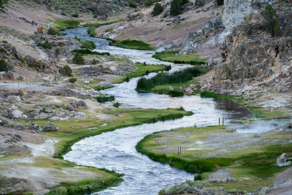
8. Hot Creek Geologic Site
309 miles from downtown Los Angeles
Just east of Mammoth, Hot Creek Geologic Site is for people interested in the area’s volcanic activity. It’s a shallow stream with bubbling, steaming pools of hot sulfurous blue pools and erupting geysers.
This site is one of the most famous photography shots in the Mammoth Lakes area, especially as the sun rises over the exquisite Sierra Nevada peaks.
Travel Tip! Even though it looks inviting, entering the water is strictly prohibited due to unpredictable changes in water temperatures.
GPS Location: (37.660442, -118.827454)
9. Convict Lake
305 miles from downtown Los Angeles
Convict Lake is a beautiful alpine lake tucked in the eastern Sierra Nevada Mountains.
The lake got its name from an incident in 1871 where prisoners escaped nearby and were rounded up at the lake.
It’s a great spot to relax on a sunny afternoon, kayak, hike, or birdwatch in the peace and tranquility of this alpine paradise. And it’s only a 15 minute detour!
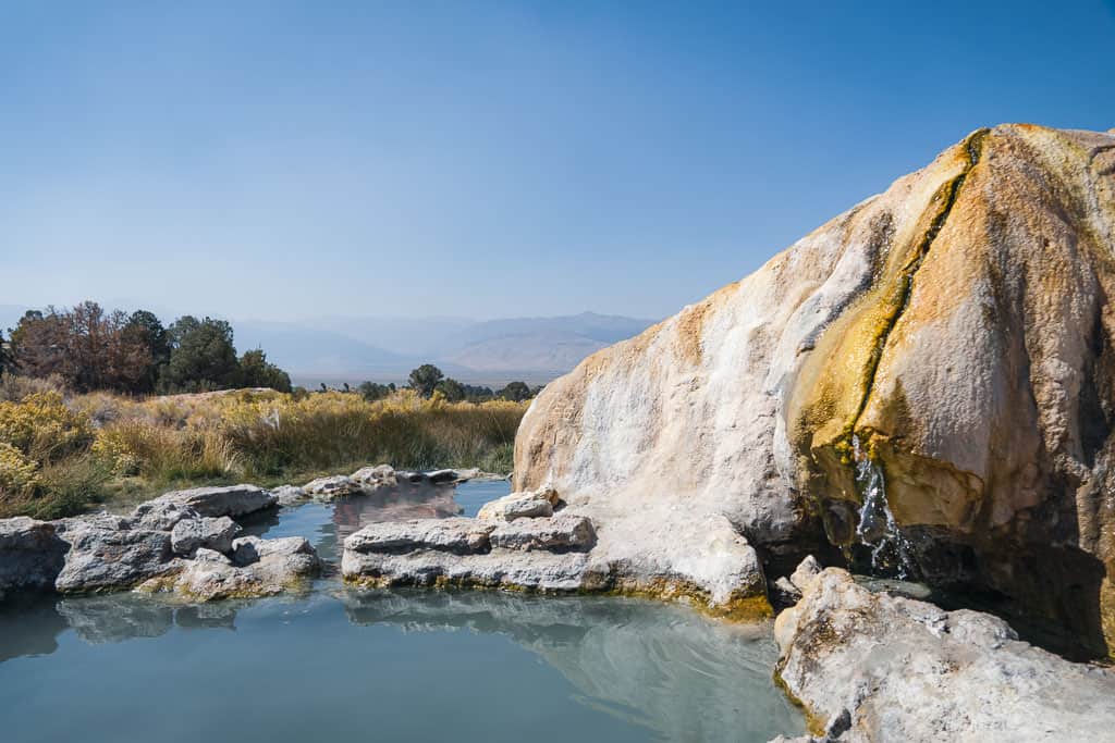
10. Highway 395 Hot Springs
Who would have known that an arid land with gorgeous mountains and alpine lakes would be sitting on the edge of an ancient volcanic crater? From Mammoth Lakes to Mono Lake, a large network of natural hot springs is just waiting for you to have a soak.
Travertine, Wild Willy’s, and Keough Hot Springs are some of my favorites, but see here for a more in-depth guide to Highway 395 hot springs.
These hot springs are worth the detour, and many are easily accessible with parking lots close to the tubs.
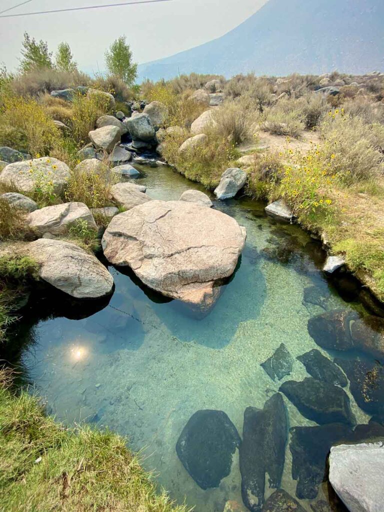
Hot Springs Information
- Many of these hot springs are undeveloped.
- Just so you’re not surprised, many hot springs are clothing optional.
- Some hot springs have posted signs about an amoeba that can attack brain tissue. Not to scare you, but don’t drink the water.
11. The Methuselah Tree – 2nd Oldest Tree in the World
284 miles from downtown Los Angeles
Once thought to be the oldest living tree in the world, the Methuselah Tree grows in the Ancient Bristlecone Pine Forest in the Inyo National Forest’s “Forest of Ancients” in eastern California’s White Mountains.
Estimated to be ~4,800 years old, the Methuselah Tree would be even older than the Egyptian pyramids. However, the world record has since been beaten by a Norway Spruce in the Swedish Arctic, aged at over 9500 years old.
Ancient Bristlecone Pine Forest Visitor Center: (37.385259, -118.178831)
12. Manzanar National Historic Site
221 miles from downtown Los Angeles
Just off Highway 395, Manzanar stands as a reminder of the injustice of forcing Japanese Americans into internment camps during World War II.
Manzanar is now an open-air museum and memorial site with exhibits telling the stories of those who lived in the camp.
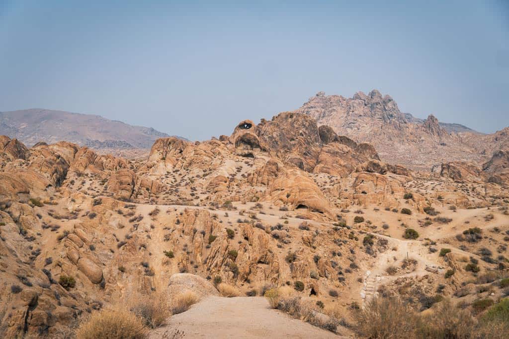
13. Alabama Hill
213 miles from downtown Los Angeles
Alabama Hill takes the cake as not only one of my favorite places in California but in the world.
If you’ve been to Joshua Tree National Park, you’ve seen the boulder-like rocks forming hills. But at Alabama Hills, those same rock formations stretch into a whole mountain range.
Get out there and get lost hiking in a different area every day while viewing the snowy Sierra Nevada towering in the back.
Travel Tip! Due to the increasing popularity of Alabama Hills, new restrictions have been implemented for boondocking on BLM land. Day Use signs have now been placed throughout the areas east of Movie Road, prohibiting overnight camping.
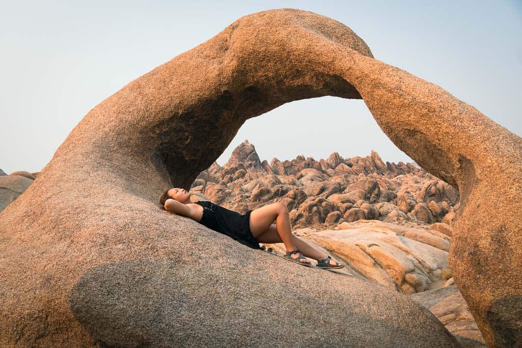
Mobius Arch
Make sure you go on the Mobius Arch Loop Trail, one of the most famous trails in Alabama Hills. This short desert trail takes you to Mobius Arch and walks amongst some of the best portions of Alabama Hills.
GPS Location: (36.613532, -118.125697)
Scenic Loop (Moffat Ranch Road – Movie Road)
A 10-mile loop takes you off Highway 395 onto Moffat Ranch Road, providing an alternative route to Alabama Hills.
While the initial stretch of this dirt road may not be remarkable, as you approach the central part of Movie Road, the true beauty of Alabama Hills shines through the dust. The best part of Alabama Hills is still the first few miles coming in from the small town of Lone Pine.
GPS Location Entrance/Exit: (36.683562, -118.107898)
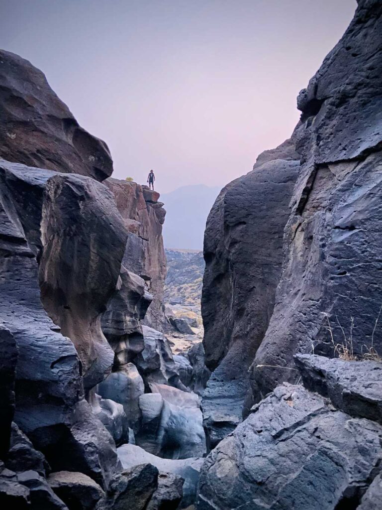
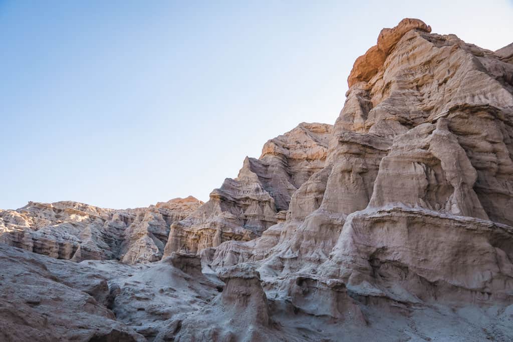
14. Fossil Falls Scenic Area
167 miles from downtown Los Angeles
It’s hard to imagine that there was so much water running through the California desert as you stand on top of Fossil Falls. While the waterfall dried up after North America’s last ice age, the polished volcanic remnants still remain.
As you drive to the parking lot, you will pass by strange color sand and mounts of volcanic rock where a river used to flow through. This 0.2 mile hike start doesn’t prepare you for what you are about to see: evidence of an ancient river wash pounding the lava flow into swiss cheese holes and shapes.
On your way there, watch for petroglyphs and shards of obsidian left by the Native Americans who inhabited this region a few thousand years ago too.
Trailhead GPS Location: (35.971633, -117.910843)
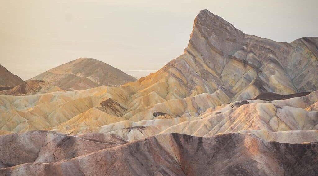
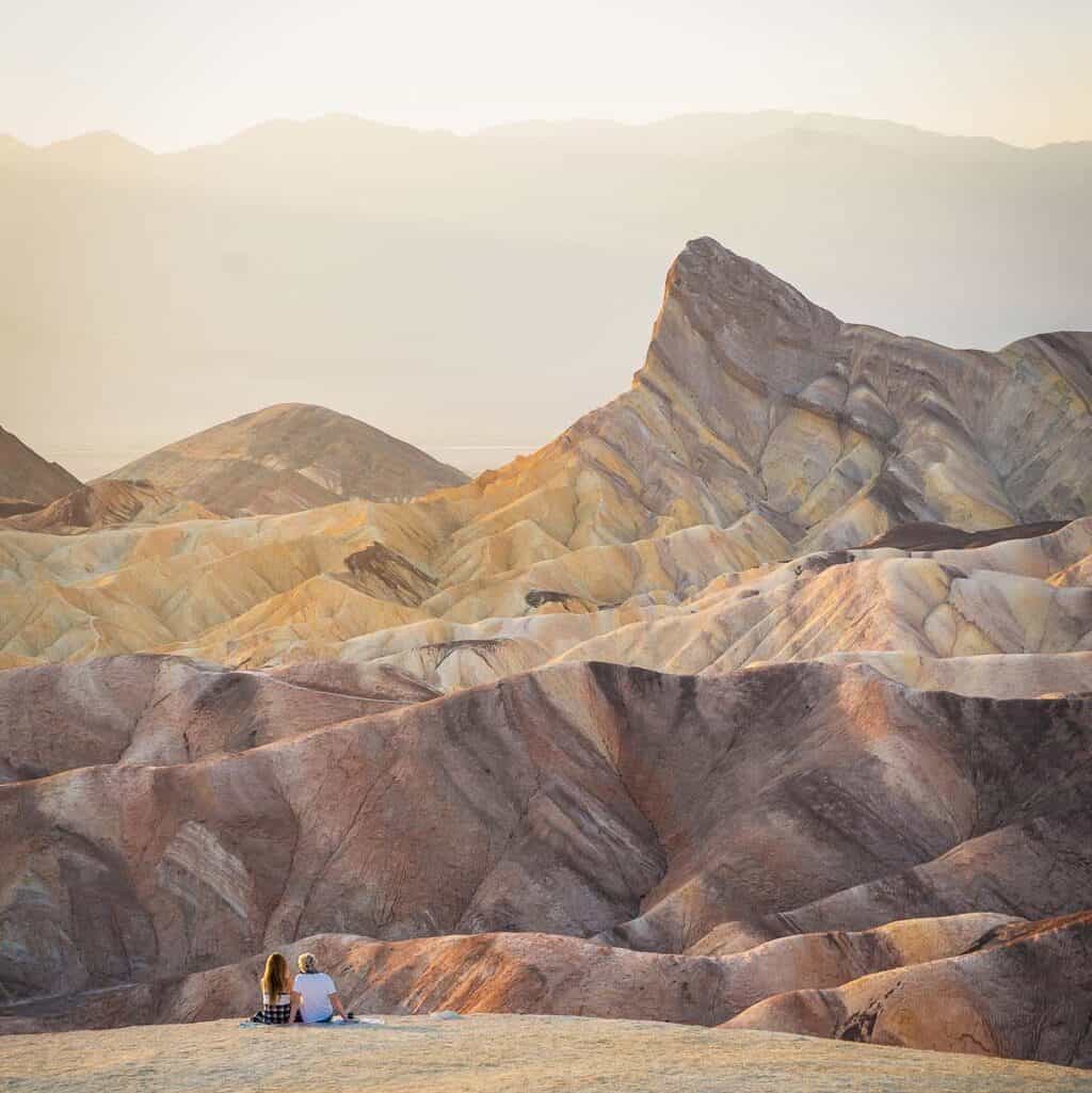
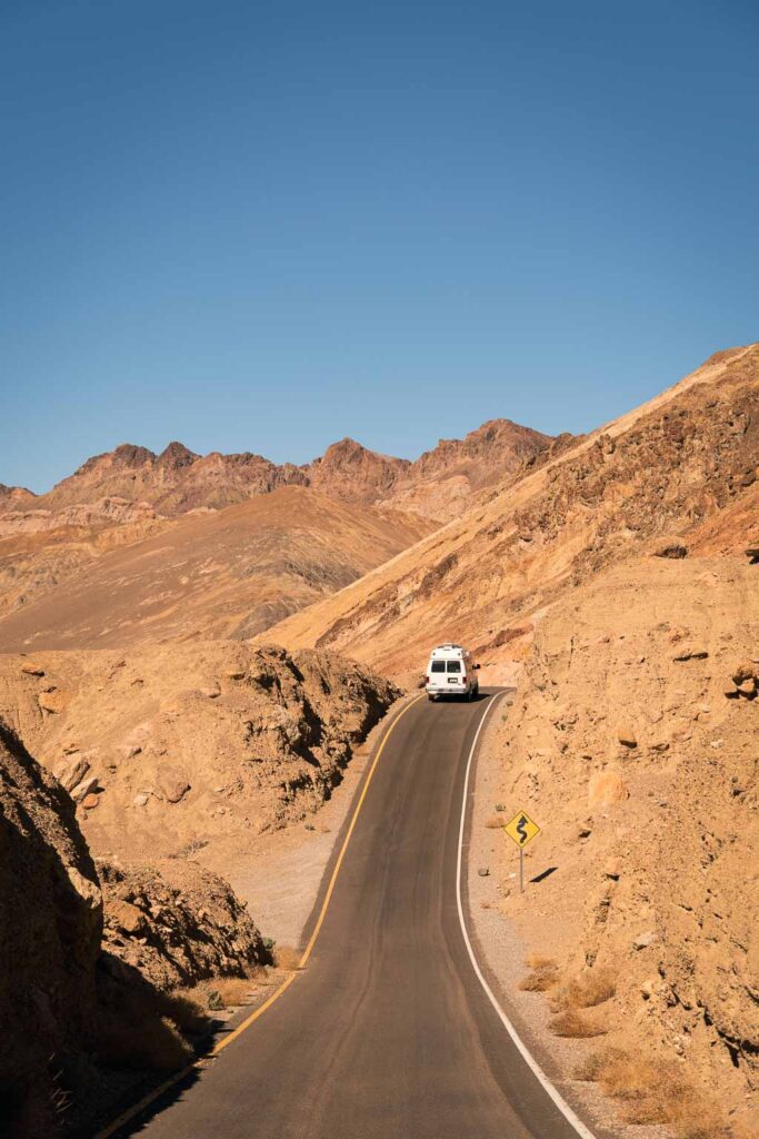
15. Death Valley National Park
216 miles from downtown Los Angeles
Drive into the hottest, driest, lowest point in the United States – Death Valley National Park. Who said that deserts were boring?
Sure, there is a lot of driving, but what makes this valley so unique are the diverse formations within. Don’t miss these Death Valley points of interest:
- The salt flats at Badwater Basin
- Mountains at Zabriskie Point and Dante’s View
- Mesquite Flat Sand Dunes
- Black volcanic fields at Ubehebe Crater
- Colorful hills of Artist’s Palette
- Cracked mud fields at Racetrack Playa
- Even a waterfall at Darwin Falls
Death Valley National Park is the third-largest national park in the United States (5,270 square miles), so it is best to go for at least two days to see everything.
Death Valley National Park has many campgrounds. The first choice is to stay near Furnace Creek, which provides a convenient starting point for your activities the next day. Alternatively, staying in Stovepipe Wells would require a longer drive.
Check if you can reserve a campground beforehand or chance it with a walk-in.
Tip: Fill up on gas before getting into the national park. Death Valley had the most expensive gas station I’d seen in the entire country!

16. Ash Meadows National Wildlife Refuge
274 miles from downtown Los Angeles
If you’re already going to Dante’s View in Death Valley National Park, head towards Vegas to detour to Ash Meadows National Wildlife Refuge to find a crystal-clear river flowing through the middle of the desert? It even has tiny fish swimming in it.
Play around Crystal Lake; just don’t get too close or risk getting stuck in thick mud.
Address: 610 Spring Meadows Rd, Amargosa Valley, NV 89020
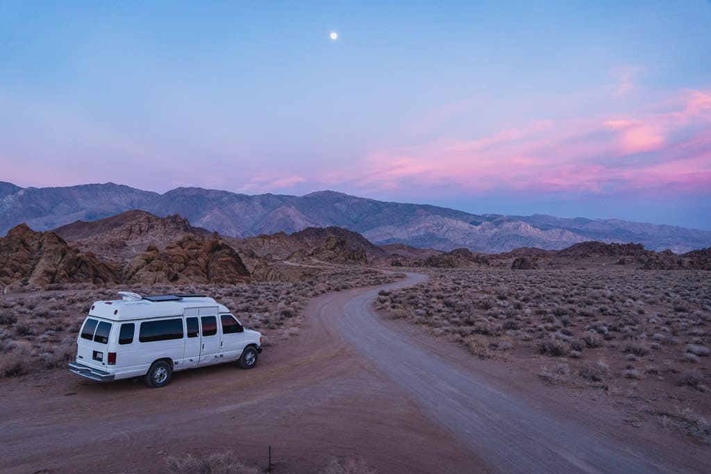
17. Ballarat Ghost Town (Population of 1)
196 miles from downtown Los Angeles
In the Panamint Valley of the Mohave Desert, on your way out from Death Valley National Park, you may pass Ballarat, an almost ghost town with a grand year-round population of 1 – one guy and his dog.
Ballarat once enticed the last of the California Gold Rush prospectors to join its census ranks, just to be another boom town when no more gold was found.
Today, it’s a good boondocking place for those about to enter the national park and check out the remnants of the buildings left over from a past era.
GPS Location: (36.047873, -117.224590)
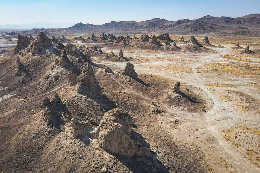
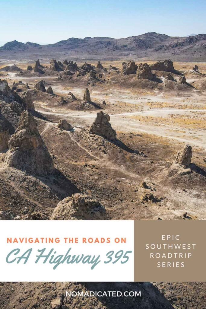
18. Trona Pinnacles
170 miles from downtown Los Angeles
You may recognize the National Natural Landmark, Trona Pinnacles, in scenes from Startrek and Planet of the Apes.
One of California’s most unusual geologic wonders, Trona Pinnacles, consists of 500 tufas reaching up to 140 feet. Formed underwater 10,000 – 100,000 years ago, the tufas formed within the long-gone Searles Dry Lake Basin.
This is a great spot for photographers looking to take some stunning photographs of an alien environment.
Trona Pinnacles is on BLM land and makes for a beautiful boondocking location. It is a short drive (5 miles) on an easy dirt road but may be impassable if it rains.
Photography Tip: Bring your drone for the best shots.
GPS Location: (35.617107, -117.368109)
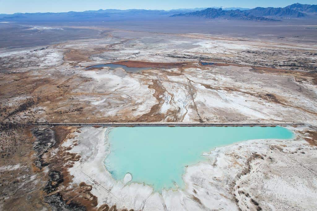
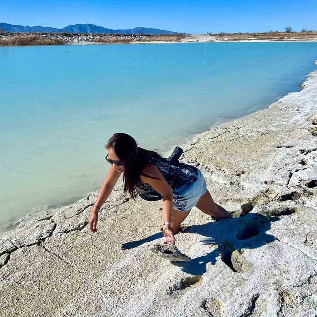
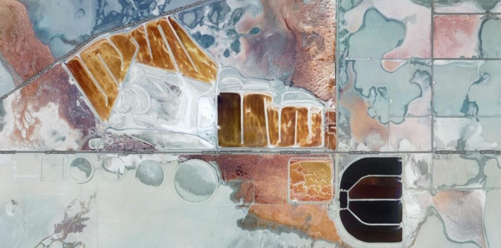
19. Colorful Toxic Lakes
My first encounters with the beautifully colorful toxic lakes in the California desert were curious pictures of a bloodshot red Owen Lake and Searles Lake’s colored grids on Google Maps.
Like the story of many lakes in the California desert, a combination of scorching temperatures, mineral mining, and man-made diversions have left many of these lakes to deplete faster than they can replenish.
Upon further research, many of these lakes are remnants of glacial meltwaters from the last ice age. As the water levels drop, the alkali salt density increases the lake’s toxicity, making it inhabitable for most living creatures.
However, an exception to this is the presence of Halobacteria, which causes the lakes to exhibit a striking red hue.
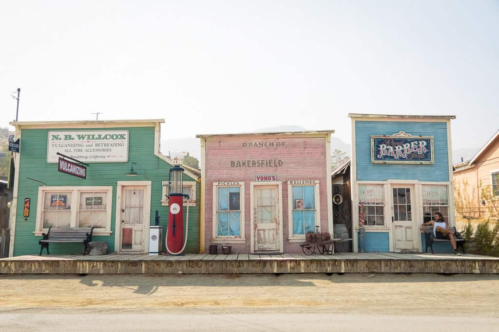
20. Randsburg Ghost Town
138 miles from downtown Los Angeles
Randsburg – one of the liveliest ghost towns around, still holds a population of 69. In the late 1800s, the mines generated sixty million dollars worth of gold by today’s valuation, and the town was booming.
Like most gold mining towns, more of the population moved on to the next money-making opportunity with every depleted vein.
The old Wild West saloon still stands proudly on Main Street – complete with swinging doors and a bar counter from the 1890s. It even boasts an original blacksmith shop and the Randsburg Hotel.
Address: 26623 Butte Ave, Randsburg, CA 93554
21. Red Rock Canyon State Park
123 miles from downtown Los Angeles
Pause for one of our final stops at Red Rock Canyon State Park before returning to civilization and eating LA’s good food.
Not a huge park, it still shows off sunning pillars and cliffs of red rocks, only a two hour drive from downtown LA. Ricardo Campground views of the red rocks are great for a final night’s rest.
For free camping, just outside the park grounds is Dove Springs OHV, BLM land for boondocking.
Address: 37749 Abbott Dr, Cantil, CA 93519
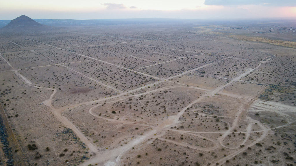
22. Walk the Empty Neighborhoods of California City
111 miles from downtown Los Angeles
The greatest suburb that never was, California City, was initially created to rival Los Angeles. Now, all that’s left are named streets and abandoned urban plans.
Looking at an aerial view, Google Maps indicates California City’s vast suburbs, only something is not quite right when you drive through. There are no houses, no foliage, no energy setup, just an empty ghost grid of suburbia.
Photography Tip: There’s no way to see a total aerial except by flying a drone to its maximum height, and even then, you can’t see it all. You could drive down what would have been the roads of the neighborhood if it had ever been built.
GPS Location: (35.1768, -117.7880)
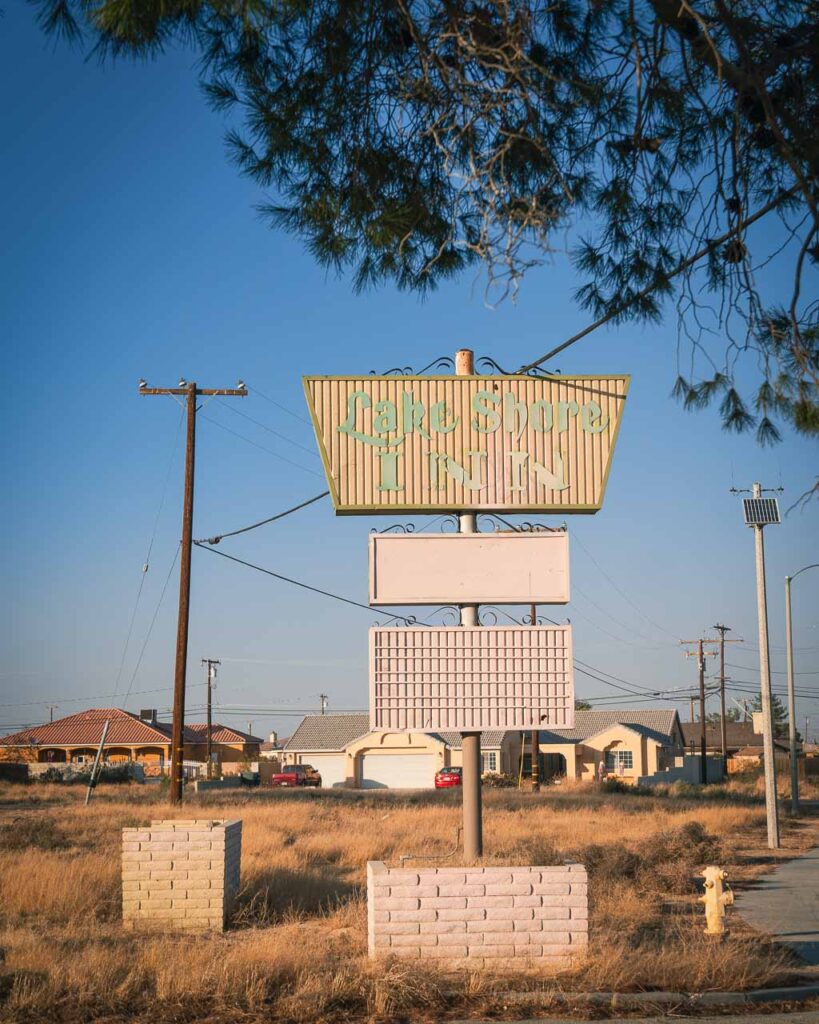
Bonus: Lake Shore Inn
A little bonus for those who like abandoned places: the infrastructure of Lake Shore Inn is still intact for a bit of exploration.
Address: 21330 Lake Shore Dr, California City, CA 93505
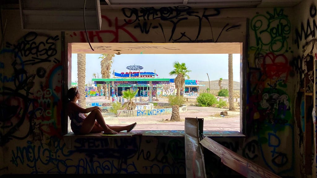
23. Urbex Lake Dolores (Rock-a-Hoola) Waterpark
136 miles from downtown Los Angeles
Between Barstow and Mojave National Preserve sits Lake Dolores Waterpark, a 1950s amusement park marked by the slogan “The Fun Spot in the Desert.”
In the midst of a barren desert, a waterpark stands isolated with little else around. Despite three separate attempts by investors to revive this abandoned attraction, their efforts were in vain.
It’s a fun and unsettling experience exploring a deserted park full of slides and pools which were once bustling with life. Today, the unnatural palm trees overgrow into the crumbling slides and lazy river, 100% graffiti’d, eerily beautiful against the desert sun.
Tip! “No Trespassing” are posted
GPS Location: (34.948036, -116.685663)

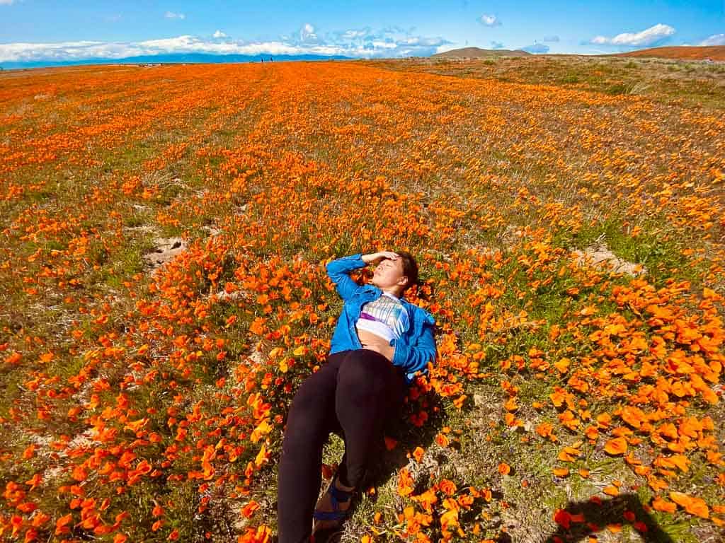
24. Antelope Valley Poppy Reserve
70 miles from downtown Los Angeles
Come to Antelope Valley Poppy Reserve in the spring to see one of the reasons why California is named the Golden State. Every year, between mid-February and May, this part of the Mojave Desert Grassland habitat comes alive with rolling hills of golden poppies.
If there is an unusually heavy season of rainfall, the wildflower landscape experiences a breathtaking superbloom. California poppies, lupines, goldfields, and other vibrant flowers burst into a colorful display.
The Antelope Valley Poppy Reserve has set up easy trails that cut through the gentle hills for you to get the best poppy viewing areas, but you can find pockets of this beauty everywhere.
Address: 15101 Lancaster Rd, Lancaster, CA 93536
25. Vasquez Rocks Natural Area Park
45 miles from downtown Los Angeles
Just north of Los Angeles, escape the city to Vasquez Rocks Natural Area Park to find some quiet roaming freely around these distinctive rocks.
Created by earthquake activity millions of years ago, the landscape varies from smooth slopes to jagged peaks across 932 acres.
The area’s isolation has made it a favorite with filmmakers looking for an otherworldly backdrop. Many movies and TV shows have been shot here, like Star Trek, Zorro, & The Flintstones.
When’s the Best Time for a Highway 395 Road Trip?
The best time to go on a desert road trip in California is the shoulder months, but anytime between late October and mid-spring is all alright.
The time of year matters here as the summer months are brutally hot.
In the winter months, Death Valley is in its peak season due to comfortable daytime temperatures, but it can drop below freezing at night. Meanwhile, nearby Mammoth Lakes is having a snow day.
#1 Tip: Bring plenty of water!
Aside from temperatures that can reach over 100 degrees and taking care so your car engine doesn’t overheat, summer is also the wildfire season in California.
Wildfire Season
Every year, these natural disasters hit the West Coast catastrophically. If there is a wildfire, winds can blow smoke hundreds of miles away, lowering air quality and obscuring any views of beautiful places.
#2 Tip: If there are reports of wildfires, I always check webcams of popular attractions to see if it is still worth going to.
FAQs About a Highway 395 Road Trip Itinerary
Is Highway 395 a scenic highway?
Yes, Highway 395 is indeed a scenic highway. It runs along the eastern side of the Sierra Nevada mountain range in California and offers views of mountains, lakes, and other natural landscapes, along with many historical points of interest.
Is Highway 395 easy to drive?
The Highway 395 road conditions are well-maintained and has clear signage, making it easy to navigate. However, many attractions are off the highway on dirt roads, which may not be suitable for some cars.
Why should I drive California’s Scenic Highway 395?
There are several reasons why you should drive California’s Scenic Highway 395. Its landscapes range from towering mountains, sparkling lakes, and expansive deserts. It also provides access to popular destinations such as Mammoth Lakes, Lake Tahoe, and Death Valley National Park.
Is Highway 395 mountainous?
Although Highway 395 runs along the eastern side of the Sierra Nevada mountain range, it is relatively flat and straight. You will have to climb steeper areas, but never actual mountain passes.
Bucket List Worthy? Highway 395 California Desert Road Trip
California offers countless amazing experiences, but the California desert holds a special spot in my heart. It’s something that completely doesn’t exist back in the East Coast, where I grew up.
It was during my first Highway 395 road trip that I fell in love with the desert, and I’ve returned multiple times since then.
If you have time for nothing else, add these stops to your Lake Tahoe to LA road trip:
- Amazing Undeveloped Hot Springs
- Mono Lake
- Death Valley National Park
- Alabama Hills
- Fossil Falls
| TRAVEL RESOURCES |
| ✈️ Find the best tours and activities with Viator to cross off your bucket list and create unforgettable memories 🏘️ Book your accommodation with Booking.com in advance and check availability on the days of your travels. 🧾 Rent a car in advance with Discovercars for those epic road trips at the best price. |
Enjoyed this post? Pin it for later!
Catherine Xu is the founder and author of Nomadicated, an adventure travel blog that helps travelers cross off their bucket list. Since discovering traveling in 2015, she has lived and journeyed to 65 countries across 5 continents and vanlifed the west coast USA for 2+ years. These days, she splits her time in Southeast Asia and California while sharing her travel stories and resources based on first-hand experiences. Catherine's other works has been referenced in major publications like MSN, Self, and TripSavvy.